Curating data from multiple Nordic sources
Features
Curated Nordic Data Access
Currently focusing on Swedish & Norwegian geotechnical markets with comprehensive historical data and full support for GeoSuite .snd formats.
Swedish & Norwegian Archives
Decades of curated geotechnical investigations from leading Nordic consultants and municipal sources.
Supporting multiple formats
Full compatibility with GeoSuite .snd files and .sgf formats
Modern Data Standards
All data available in contemporary formats for seamless integration with geotechnical workflows.
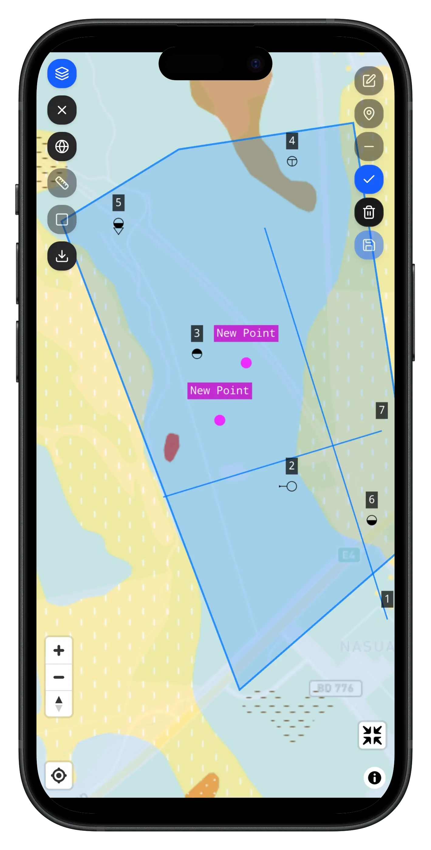
Advanced Nordic Visualization
Beta platform featuring 2D/3D visualization optimized for Nordic geological conditions and soil types. Integrated with official terrain elevation data from Lantmäteriet and Kartverket for comprehensive terrain analysis.
Nordic-Optimized 2D/3D Views
Visualization tools adapted for Scandinavian soil conditions with integrated terrain elevation data from Lantmäteriet and Kartverket.
Regional Cross-Sections
Generate cross-sections with Nordic soil classification and interpretation standards combined with official terrain data.
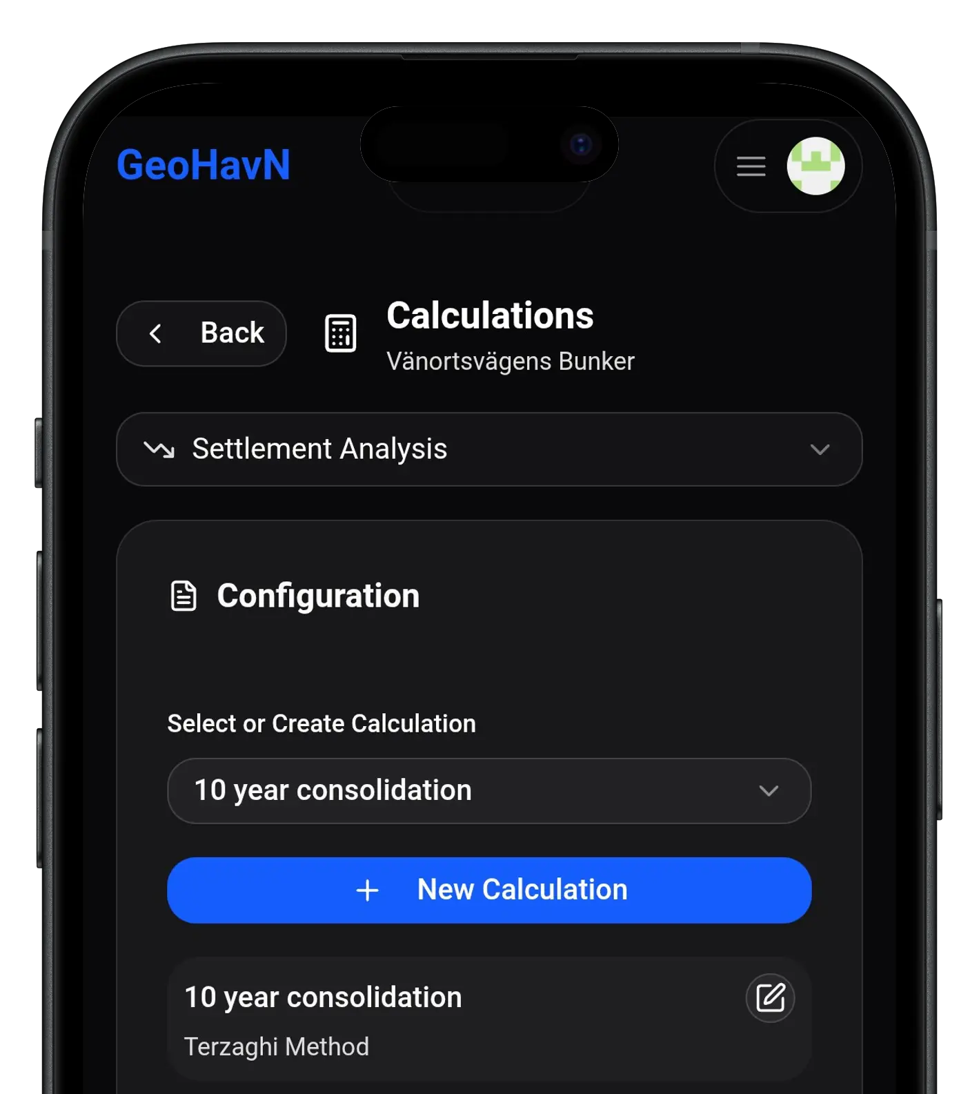
Nordic Calculation Workflows
Analysis tools integrated with Swedish and Norwegian geotechnical calculation workflows and engineering praxis.

International Expansion Ready
Platform designed for global scalability. Looking to collaborate with international partners to expand beyond Nordic markets. Reach out to discuss opportunities!
Scalable Architecture
Platform built to easily accommodate additional regional datasets and standards.
Collaboration Opportunities
Seeking partners to expand to new markets - contact us to discuss collaboration.
Beta Program Benefits
Early access to features, direct feedback influence, and preferential partnership terms.

Pricing Tailored to Your Needs
One solution that adapts to your specific requirements and usage patterns.
FEATURES
- Single user access
- Swedish & Norwegian geotechnical data with continuous updates
- Standard format support (.snd, .sgf)
- Up to 1,000 API calls per month
- Email support
- Data viewing and basic analysis tools
- Export to common formats
- Beta program access and early features
FEATURES
- Multiple user accounts and team management
- Full platform access with advanced features
- Swedish & Norwegian geotechnical data with continuous updates
- Multiple format support (.snd, .sgf, and more)
- Unlimited API calls and integrations
- Priority support and dedicated account manager
- Custom integrations and workflows
- Advanced collaboration tools
- Custom reporting and analytics
Nordic Beta Users
Early feedback from Swedish and Norwegian geotechnical professionals.
"Easy to use for geotechnical planning, getting an instant 3D model is extremely valuable together with the ability to import and view geotechnical soundings."
Geotechnical Engineer
"We've been using Geohavn doing field work, it works amazing and gives the geotechnical engineer an instant way to see the performed investigation without having to email back and forth."
Geotechnical Field Engineer
"Geohavn has made it much easier to see where our projects are and what previous geotechnical investigations our company has done at a site. Can't wait for Geohavn to curate more datasets for us!"
Geotechnical Engineer
100,000+
Goal to curate over 100,000 boreholes by the end of 2025 across Swedish & Norwegian markets.
1,000+
Hours saved through streamlined data access workflows during our beta phase.
Beta
Currently curating datasets with active Nordic engineering firms in our beta program.